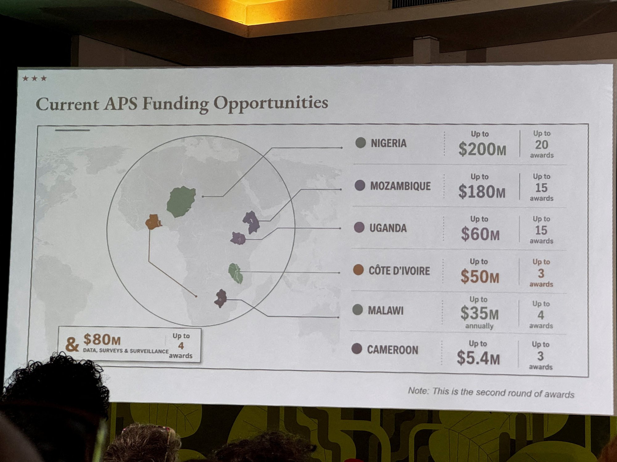
A map of Africa shared by the US Government mislabelled every country "due to artificial intelligence". During a State Department presentation at a global conference in Brazil, the error-strewn map relocated a number of African countries elsewhere on the continent. Footage showed attendees of the Aids 2026 conference in Rio de Janeiro capturing the moment audience members noticed the mistake. Subsequent analysis of the image indicated that the map was whipped up by a staff member using artificial intelligence, made with OpenAI tools. TRENDING Stories Videos Your Say The image showed Nigeria being landlocked somewhere in the Sahara Desert, while Mozambique was shifted to the Horn of Africa.Meanwhile, Côte d'Ivoire in the west was...
Read the full article at the source.
,xPosition=.5,yPosition=.5;Resize=(1200,675)&impolicy=medium)

Comments (0)
No comments yet. Be the first to comment!